Sunday, July 22, 2012

Day 10 – Tuesday, June 12th, 2012


Thurso to MacDuff, we thought!

But first I need to make a comment on the history of the Orkneys.  The Orkney Islands is an archipelago in northern Scotland, comprising approximately 70 islands of which 20 are inhabited.  The largest island is known as the "Mainland".  They fly their own flag closely related to the design of the Norwegian flag but red and yellow in colour.


The name "Orkney" dates back to the 1st century BC or earlier and the islands have been inhabited for at least 8,500 years.  Originally occupied by Mesolithic and Neolithic tribes and then by the Picts, Orkney was invaded and forcibly annexed by Norway in 875 and settled by the Norse.  It was subsequently annexed to the Scottish Crown in 1472, following the failed payment of a dowry for James III's bride, Margaret of Denmark.

A charred hazelnut shell, recovered in 2007 during excavations in Tankerness on the Mainland has been dated to 6820-6660 BC indicating the presence of Mesolithic nomadic tribes.  The earliest known permanent settlement is at Knap of Howar, a Neolithic farmstead on the island of Papa Westray, which dates from 3500 BC.

During the Roman invasion of Britain the "King of Orkney" was one of 11 British leaders who is said to have submitted to the Emperor Claudius in AD 43 at Colchester.  After the Agricolan fleet had come and gone, possibly anchoring at Shapinsay, direct Roman influence seems to have been limited to trade rather than conquest.

By the late Iron Age, Orkney was part of the Pictish kingdom, and although the archaeological remains from this period are less impressive there is every reason to suppose the fertile soils and rich seas of Orkney provided the Picts with a comfortable living.  However, before the Gaelic presence could establish itself the Picts were gradually dispossessed by the Norsemen from the late 8th century onwards.  The nature of this transition is controversial, and theories range from peaceful integration to enslavement and genocide.


Both Orkney and Shetland saw a significant influx of Norwegian settlers during the late 8th and early 9th centuries.

The martyrdom of Magnus Erlendsson, who was killed in April 1116 by his cousin Haakon Paulsson, resulted in the building of St. Magnus Cathedral, still today a dominating feature of Kirkwall.

In 1468 Orkney was pledged by Christian I, in his capacity as king of Norway, as security against the payment of the dowry of his daughter Margaret, betrothed to James III of Scotland.  As the money was never paid, the connection with the crown of Scotland has become perpetual.

The history of Orkney prior to this time is largely the history of the ruling aristocracy.  From now on the ordinary people emerge with greater clarity.  An influx of Scottish entrepreneurs helped to create a diverse and independent community that included farmers, fishermen and merchants that called themselves comunitas Orcadie and who proved themselves increasingly able to defend their rights against their feudal overlords.

From at least the 16th century, boats from mainland Scotland and the Netherlands dominated the local herring fishery.  There is little evidence of an Orcadian fleet until the 19th century but it grew rapidly and 700 boats were involved by the 1840s with Stronsay and then later Stromness becoming leading centres of development.  White fish never became as dominant as in other Scottish ports.

In the 17th century, Orcadians formed the overwhelming majority of employees of the Hudson's Bay Company in Canada.  The harsh climate of Orkney and the Orcadian reputation for sobriety and their boat handling skills made them ideal candidates for the rigours of the Canadian north.  During this period, burning kelp briefly became a mainstay of the islands' economy.

Agricultural improvements beginning in the 17th century resulted in the enclosure of the commons and ultimately in the Victoria era the emergence of large and well-managed farms using a five-shift rotation system and producing high quality beef cattle.

Also, I need to make comment on John rae as advised by Lord Doug Rae.

John Rae (Inuktitut: Aglooka, English: “He who takes long strides”; 30 September 1813 – 22 July 1893) was a Scottish doctor who explored Northern Canada, surveyed parts of the Northwest Passage and reported the fate of the Franklin Expedition.

Rae was born at the Hall of Clestrain in the parish of Orphir in Orkney.  After studying medicine at Edinburgh he went to work for the Hudson's Bay Company as a doctor, accepting a post as surgeon at Moose Factory, Ontario, where he remained for ten years.

Whilst working for the company, treating both European and indigenous employees of the company, Rae became known for his prodigious stamina and skilled use of snow shoes.  He learned to live off the land like the Inuit and working with the local craftsmen, designed his own snow shoes.  This knowledge allowed him to travel great distances with little equipment and few followers, unlike many other explorers of the Victorian Age.

In 1844–45, wanting to learn how to survey, Rae walked 1200 miles over two months in the winter forest, a feat that earned him the Inuit nickname Aglooka, "he who takes long strides."  In 1846 Rae went on his first expedition and in 1848 joined Sir John Richardson in searching for the Northwest Passage.

By 1849 Rae was in charge of the Mackenzie River district at Fort Simpson.  He was soon called upon to head north again, this time in search of two missing ships from the Franklin Expedition.  While exploring the Boothia Peninsula in 1854 Rae made contact with local Inuit, from whom he obtained much information about the fate of the lost naval expedition.  His report to the British Admiralty carried shocking and unwelcome evidence that cannibalism had been a last resort for some of the survivors.  When it was leaked to the Press, Franklin's widow Lady Jane Franklin was outraged and recruited many important supporters, among them Charles Dickens who wrote several pamphlets condemning Rae for daring to suggest British Naval sailors would have resorted to cannibalism.

In 1860 Rae worked on the telegraph line to America, visiting Iceland and Greenland.  In 1864 he made a further telegraph survey in the west of Canada.  In 1884 at age 71 he was again working for the Hudson's Bay Company, this time as an explorer of the Red River for a proposed telegraph line from the United States to Russia.

John Rae died from an aneurysm in London on 22 July 1893.  A week later his body arrived in Orkney. He was buried in the kirkyard of St Magnus' Cathedral, Kirkwall.  A memorial to him is inside the cathedral.

The outcome of Lady Franklin's efforts to glorify the dead of the Franklin expedition meant Rae was shunned somewhat by the British establishment.  Although he found the last link in the much-sought-after Northwest Passage Rae was never awarded a Knighthood, nor was he remembered at the time of his death, dying quietly in London.  In comparison fellow Scot and contemporary explorer David Livingstone was knighted and buried with full imperial honours in Westminster Abbey.

Historians have since studied Rae's expeditions and his roles in finding the Northwest Passage and learning the fate of Franklin's crews.  Authors such as Ken McGoogan have noted Rae was willing to adopt and learn the ways of indigenous Arctic peoples, which made him stand out as the foremost specialist of his time in cold-climate survival and travel.  Rae also respected Inuit customs, traditions and skills, which went against the beliefs of many 19th century Europeans that most native peoples were primitive and of little educational value.

In July 2004, Orkney and Shetland MP Alistair Carmichael introduced into the UK Parliament a motion proposing, inter alia, that the House "regrets that Dr Rae was never awarded the public recognition that was his due".  In March 2009 he introduced a further motion urging Parliament to formally state it "regrets that memorials to Sir John Franklin outside the Admiralty headquarters and inside Westminster Abbey still inaccurately describe Franklin as the first to discover the [North West] passage, and calls on the Ministry of Defence and the Abbey authorities to take the necessary steps to clarify the true position.

We departed Thurso after breakfast and took a series of back roads meandering towards Wick, arriving in time for a morning coffee break.

Wick's history stretches back, at least, to the era of Norwegian rule in Caithness, which ended, conclusively, in 1266's Treaty of Perth.

Little is known of the early history of this Northern Scottish town but there is ample evidence in the surrounding countryside of Neolithic/Bronze Age settlement and the shelters and defences of succeeding Ages.  However, it was the Vikings that gave Wick its name (from the old Norse vik meaning bay).
Although King James the VI of Scotland made Wick a Royal Burgh in 1589 it was not until the beginning of the 19th century that the town began to realise its potential.  By 1860 it had grown to be Europe's premier herring fishing port.  The town's development around the fickle fortunes of fishing is a remarkable story of vision, good planning, investment, courage, hardship and industry.

Pulteneytown is an area of Wick on the south side of the River Wick.  Until 1902 Pulteneytown was administered separately from Wick.  Pulteneytown takes its name from Sir William Pulteney, 5th Baronet, a governor of the British Fisheries Society.  In the early years of the 19th century Sir William commissioned Britain's leading civil engineer, Thomas Telford, to design and supervise the creation of a major new herring fishing town and harbour at the estuary of the River Wick.  Pulteneytown was so named after the death of Sir William in 1805 and became a major player in the 19th century herring boom.  It was built in order to supply work to the Gaels evicted during the Highland Clearances.  During this boom period the harbour was expanded still further by local shipbuilder James Bremner.  History of this era is preserved in the collections of Wick Heritage Museum.


After a delicious coffee, scone and fresh jam, it was off to Inverness.

The Castle of Old Wick is on the coast 1km south of the town.  The Castle of Old Wick dates to the 12th century, and is one of the best preserved Norse fortifications in all of Scotland.


Our first stop after Wick was the Camster Cairns.  Located 8 miles southwest of Wick, the Camster Cairns are amongst the best-preserved Neolithic chambered cairns in the British Isles.  Known as the Grey Cairns of Camster, they comprise a round cairn, a long cairn and a ruined third cairn lying 200m apart.  Built around 3500BC, the cairns are thought to have been in use as burial chambers and as ritual sites for several hundred years thereafter.  Both cairns are of dry-stone construction, the round cairn is 18m in diameter and 3.7m high and the long cairn is 69.5m long and 16.8m wide.


The cairns were excavated in 1865 and pottery, skeletons, burnt bone and flint tools were recovered from the round cairn.  There is one central chamber in the round cairn, which retains its original roof, and two burial chambers in the long cairn.  Modern excavations were completed on the long cairn in 1980 and its collapsed roof has recently been replaced with fibreglass with sky-lights which allow light into the interior.  The walls, which had been plundered to build a nearby sheep-pen, were restored using original materials.  The cairn complex is now in the care of Historic Scotland.


Leaving the Cairns we drove to Dunrobin Castle.

Dunrobin Castle is a stately home in Sutherland.  It is the seat of the Countess of Sutherland and the Clan Sutherland.  It is located 1 mile north of Golspie on the Dornoch Firth.  Dunrobin's origins lie in the Middle Ages, but most of the present building is the work of Sir Charles Barry, the architect of the Palace of Westminster in London, who greatly extended the building in 1845.  The resulting house has a "French Renaissance meets Scots Baronial" style.

The lands of Sutherland were acquired before 1211, by Hugh, Lord of Duffus, grandson of the Flemish nobleman, Freskin.  The Earldom of Sutherland was created around 1230 for Hugh's son, William, and the first record of a castle on this site dates to 1401.  It may have been built on the site of an early medieval fort (hence, the dun in the place-name).  The earliest castle was a square keep with few, and small, windows.  The Earldom passed to the Gordon family in the 16th century.

During the Jacobite Rising of 1745, the Jacobites under Charles Edward Stuart stormed Dunrobin Castle without warning, because the Clan Sutherland supported the British government.  The 17th Earl of Sutherland, who had changed his surname from Gordon to Sutherland, narrowly escaped them, exiting through a back door.  He sailed for Aberdeen where he joined the Duke of Cumberland's army.  On the death of the 18th Earl in 1766, the house passed to his daughter, Elizabeth, who married the politician George Leveson-Gower, later created 1st Duke of Sutherland.

Since 1973 the house and grounds have been open to the public, with private accommodation retained for the use of the Sutherland family.  However I refused to pay an entry fee after reading about the Sutherlands participation in the Highland “clearances”.


The Highland Clearances was the forced displacement of a significant number of people in the Scottish Highlands during the 18th and 19th century, as a result of an agricultural revolution (also known as enclosure) carried out by hereditary aristocratic landowners, such as the Duke of Sutherland.  The changes were seen to be supported by the government, who gave financial aid for roads and bridges to assist the new sheep-based agriculture and trade.  There was mass forced emigration to the sea coast, the Scottish Lowlands, and the North American colonies.  The clearances were particularly notorious as a result of the late timing, the lack of legal protection for year-by-year tenants under Scots law, the abruptness of the change from the traditional clan system, and the brutality of many evictions.

The enclosures that depopulated rural England in the British Agricultural Revolution started much earlier, during theTudor period, and similar developments in Scotland have lately been called the Lowland Clearances by historians such as Tom Devine.  But in the Highlands the impact on a Goidelic (Scottish Gaelic)-speaking semi-feudal culture that still expected obligations of a chief to his clan led to vocal campaigning and a lingering bitterness among the descendants of those forced to emigrate or to remain in crofting townships on very small areas of poor farming land.  Crofters became a source of virtually free labour to their landlords, being forced to work long hours in such work as harvesting and processing of kelp.


From the late 16th century, laws required clan leaders to appear in Edinburgh regularly to provide bonds for the conduct of anyone in their territory.  This created a tendency among chiefs to see themselves as landlords.  The lesser clan-gentry increasingly took up droving, taking cattle along the old unpaved drove roads to sell in the Lowlands.  This brought wealth and land ownership within the clan, though the Highlands continued to be overpopulated and poor.

The Jacobite Risings brought repeated British government efforts to curb the clans, culminating after the 1746 Battle of Culloden with brutal repression.  The Act of Proscription of 1746 incorporating the Dress Act required all swords to be surrendered to the government and prohibited the wearing of tartans or kilts.  The Tenures Abolition Act 1660 ended the feudal bond of military service and the Heritable Jurisdictions Act removed the virtually sovereign power the chiefs held over their clan.  The extent of enforcement of the prohibitions varied and related to a clan's support of the government during the rebellion, but over all led to the destruction of the traditional clan system and of the supportive social structures of small agricultural townships.

From about 1725, in the aftermath of the first Jacobite Rising, Highlanders had begun emigrating to the Americas in increasing numbers.  The Disarming Act of 1746 and the Clan Act made ineffectual attempts to subdue the Scottish Highlands, and eventually troops were sent in.  Government garrisons were built or extended in the Great Glen at Fort William, Kiliwhimin (later renamed Fort Augustus) and Fort George, Inverness, as well as barracks at Ruthven, Bernera and Inversnaid, linked to the south by the Wade roads (constructed for Major-General George Wade).  These had the effect of limiting organisational travel and choking off news and further isolated the clans.  Nevertheless, conditions remained unsettled for the whole decade.

In 1725 General Wade raised the independent companies of the Black Watch as a militia force to keep peace in the unruly Highlands.  This increased exodus of Highlanders to the Americas.  Increasing demand in Britain for cattle and sheep and the creation of new breeds of sheep such as the black-faced, which could be reared in the mountainous country, allowed higher rents for landowners and chiefs to meet the costs of their aristocratic lifestyle.  As a result, families living on a subsistence level were displaced, exacerbating the unsettled social climate.  In 1792 tenant farmers from Strathrusdale led a protest against the policy by driving over 6,000 sheep off the land surrounding Ardross.  This action was dealt with at the highest levels in government, with the Home Secretary Henry Dundas getting involved.  The Black Watch was mobilised; it halted the drive and brought the ringleaders to trial.  They were found guilty, but later escaped custody and disappeared.

What became known as the Clearances were considered by the landlords as necessary "improvements".  They are thought to have been begun by Admiral John Ross of Balnagowan Castle in 1762.  MacLeod of MacLeod(i.e. the chief of MacLeod) began experimental work on Skye in 1732.  Chiefs engaged Lowland, or sometimes English, factors with expertise in more profitable sheep farming, and they "encouraged", sometimes forcibly, the population to move off suitable land.

Another wave of mass emigration came in 1792, known as the "Year of the Sheep" to Scottish Highlanders.  The people were accommodated in poor crofts or small farms in coastal areas where farming could not sustain the communities and they were expected to take up fishing.  In the village of Badbea in Caithness the conditions were so harsh that, while the women worked, they had to tether their livestock and even their children to rocks or posts to prevent them being blown over the cliffs.  Others were put directly onto emigration ships to Nova Scotia (Antigonish and Pictou counties and later Cape Breton), the Glengarry and Kingston areas of Ontario and the Carolinas of the American colonies.  There may have been a religious element in these forced removals since many Highlanders were Roman Catholic.  This is reflected by the majority representation of Catholics in areas and towns of Nova Scotia such as Antigonish and Cape Breton.  However almost all of the very large movement of Highland settlers to the Cape Fear region of North Carolina were Presbyterian.

In 1807 Elizabeth Gordon, 19th Countess of Sutherland, touring her inheritance with her husband Lord Stafford (later made Duke of Sutherland), wrote that "he is seized as much as I am with the rage of improvements, and we both turn our attention with the greatest of energy to turnips".  As well as turning land over to sheep farming, Stafford planned to invest in creating a coal pit, salt pans, brick and tile works and herring fisheries.  That year his agents began the evictions, and 90 families were forced to leave their crops in the ground and move their cattle, furniture and timbers to the land they were offered 20 miles away on the coast, living in the open until they had built themselves new houses.  Stafford's first Commissioner, William Young, arrived in 1809, and soon engaged Patrick Sellar as his factor who pressed ahead with the process while acquiring sheep farming estates for himself.

Elsewhere, the flamboyant Alexander Ranaldson MacDonell of Glengarry portrayed himself as the last genuine specimen of the true Highland Chief while his tenants were subjected to a process of relentless eviction.

To landlords, "improvement" and "clearance" did not necessarily mean depopulation.  At least until the 1820s, when there were steep falls in the price of kelp, landlords wanted to create pools of cheap or virtually free labour, supplied by families subsisting in new crofting townships.  Kelp collection and processing was a very profitable way of using this labour, and landlords petitioned successfully for legislation designed to stop emigration.  This took the form of the Passenger Vessels Act 1803.  Attitudes changed during the 1820s and, for many landlords, the potato famine which began in 1846 became another reason for encouraging or forcing emigration and depopulation.

As in Ireland, the potato crop failed in the mid nineteenth century, and a widespread outbreak of cholera further weakened the Highland population.  The ongoing clearance policy resulted in starvation, deaths, and a secondary clearance, when families either migrated voluntarily or were forcibly evicted.  There were many deaths of children and old people.  As there were few alternatives, people emigrated, joined the British army, or moved to growing urban centres such as Glasgow, Edinburgh, and Dundee in Lowland Scotland and Newcastle-upon-Tyne and Liverpool in the north of England.  In places some people were given economic incentives to move, but few historians dispute that in many instances landlords used violent methods.
Donald McLeod, a Sutherland crofter, later wrote about the events he witnessed:

The consternation and confusion were extreme.  Little or no time was given for the removal of persons or property; the people striving to remove the sick and the helpless before the fire should reach them; next, struggling to save the most valuable of their effects.  The cries of the women and children, the roaring of the affrighted cattle, hunted at the same time by the yelling dogs of the shepherds amid the smoke and fire, altogether presented a scene that completely baffles description — it required to be seen to be believed.

A dense cloud of smoke enveloped the whole country by day, and even extended far out to sea.  At night an awfully grand but terrific scene presented itself — all the houses in an extensive district in flames at once.  I myself ascended a height about eleven o'clock in the evening, and counted two hundred and fifty blazing houses, many of the owners of which I personally knew, but whose present condition — whether in or out of the flames — I could not tell.  The conflagration lasted six days, till the whole of the dwellings were reduced to ashes or smoking ruins.  During one of these days a boat actually lost her way in the dense smoke as she approached the shore, but at night was enabled to reach a landing-place by the lurid light of the flames.

Accounts like those of McLeod and General David Stewart of Garth brought widespread condemnation and The Highland Land League eventually achieved land reform in the enactment of Crofting Acts, but these could not bring economic viability and came too late at a time when the land was already suffering from depopulation.

It was only in the mid-nineteenth century that the second, more brutal phase of the Clearances began; this was well after the 1822 visit by George IV, when lowlanders set aside their previous distrust and hatred of the Highlanders and identified with them as national symbols.  However, the cumulative effect was particularly devastating to the cultural landscape of Scotland in a way that did not happen in other areas of Britain.

Elizabeth Leveson-Gower, Duchess of Sutherland, and her husband George Leveson-Gower, 1st Duke of Sutherland, conducted brutal clearances between 1811 and 1820.  Evictions at the rate of 2,000 families in one day were not uncommon.  Many starved and froze to death where their homes had once been.  The Duchess of Sutherland, on seeing the starving tenants on her husband's estate, remarked in a letter to a friend in England, "Scotch people are of happier constitution and do not fatten like the larger breed of animals."
While the collapse of the clan system can be attributed more to economic factors and the repression that followed the Battle of Culloden, the widespread evictions resulting from the Clearances severely affected the viability of the Highland population and culture.  To this day, the population in the Scottish Highlands is sparse and the culture is diluted, and there are many more sheep than people.

However, the Clearances did result in significant emigration of Highlanders to North America and Australasia— where today are found considerably more descendants of Highlanders than in Scotland itself.
One estimate for Cape Breton, Nova Scotia has 25,000 Gaelic-speaking Scots arriving as immigrants between 1775 and 1850.  At the beginning of the twentieth century, there were an estimated 100,000 Gaelic speakers in Cape Breton, but because of economic migration to English-speaking areas and the lack of Gaelic education in the Nova Scotian school system, the numbers of Gaelic speakers fell dramatically.  By the beginning of the 21st century, the number of native Gaelic speakers had fallen to well below 1,000.

A major destination for these emigrants in the 18th century was Glengarry County, an a original settlement for Highland Scots in what is now present-day eastern Ontario.  Gaelic was the native tongue of the settlement in which thousands of people spoke the language throughout the 18th and 19th centuries.  However, the number of native speakers has decreased since in result of English and French migration throughout the county.  In respect for their and their ancestors' Scottish culture, the county hosts the annual Glengarry Highland Games, one of the biggest Highland Games gatherings of its kind outside Scotland.

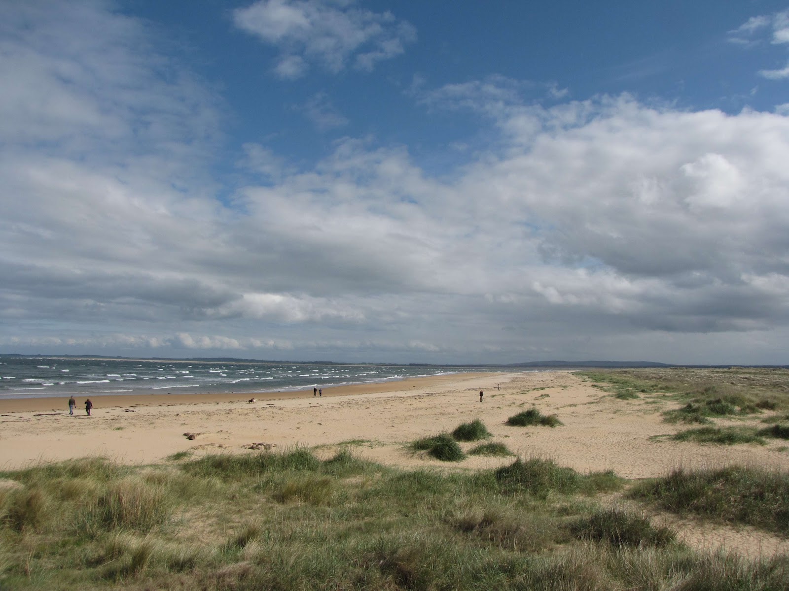
From Dunrobin Castle it was off to Dornock for a brief stop to admire the beautiful sand beach.


After starting up we had some trouble with the clutch of the rental car and had to pull off the highway between Tore and Inverness.  After 2 hours we were met by AA and driven to the rental dealer in Inverness with the vehicle loaded behind.  A quick exchange of vehicles and a decision to stay the night in Inverness took us to The Alexander Guest House.


The Alexander is located very centrally in Inverness, immediately overlooking the river, opposite the Cathedral and close to the Castle. It is a five minute walk to the City Centre.

The Alexander has a very contemporary feel; subtle colours have been used throughout to create a light and airy mood and to complement the elegant layout of the Georgian rooms to give that real “home from home” in the Highlands.


We dined at Nicos Seafood Restaurant, next to The Alexander and then off to bed.


Tuesday, July 17, 2012

Day 9 – Monday, June 11th. 2012


To the Orkneys!

After a discussion with our hosts at the Royal Hotel we decide to take a bus trip around the Orkneys.  The decision is predicated by a desire to take a much needed rest from driving.  We depart Thurso for a short 20 minute drive to John o’ Groats.

On the way we pass by Dunnet Head.


Dunnet Head is a peninsula on the north coast of Scotland, that includes the most northerly point of the mainland of Great Britain.  The peninsula is east of the Thurso, and on a clear day, it affords excellent views of the islands of Stroma and Swona to the east, and Hoy and the Orkney Mainland, 15 km (nine miles) away to the north, across the Pentland Firth.

A further 3 miles and we reach John o' Groats, a village popular with tourists because it is usually regarded as the most northerly settlement of mainland Great Britain, although this is not a claim made by the inhabitants and is false.


The town takes its name from Jan de Groote, a Dutchman who obtained a grant for the ferry from the Scottish mainland to Orkney, recently acquired from Norway, from King James IV in 1496.  People from John o' Groats are known as "Groatsers".  Local legend has the name John o' Groats termed to reflect the Dutch ferryman's charge of one groat payment for the ride to the islands.

The phrase Land's End to John o' Groats (LEJOG) is frequently heard both as a literal journey (being the longest possible in Great Britain) and as a metaphor for great or all-encompassing distance, similar to the American phrase coast to coast.

The ferry takes just 40 minutes to cover the old sea route to Orkney across the famous Pentland Firth which links the Atlantic Ocean with the North Sea.


The Maxi coach was waiting for us at Burwick.


In a very few minutes we are ready to drive across the Churchill Barriers which were built in the 1940s and thread five islands together to form the eastern boundary of Scapa Flow.


Scapa Flow is a body of water in the Orkney Islands sheltered by the islands of Mainland, Graemsay, Burray, South Ronaldsay and Hoy.  It is about 312 square kilometres.  It has a shallow sandy bottom not deeper than 60 metres and most of it about 30 metres deep, and is one of the great natural harbours/anchorages of the world, with sufficient space to hold a number of navies.  Viking ships anchored in Scapa Flow more than 1000 years ago, but it is best known as the site of the United Kingdom's chief naval base during WWI and WWarII.  The base was closed in 1956.

The Viking expeditions to Orkney are recorded in detail.  King Haakon IV of Norway anchored his fleet, including the flagship Kroussden that could carry nearly 300 men, on 5 August 1263 at St Margaret's Hope, where he witnessed an eclipse of the sun prior to sailing south to the Battle of Largs.  En route back to Norway Haakon anchored some of his fleet in Scapa Flow for the winter, but he died that December whilst staying at the Bishop's Palace in Kirkwall.

Historically, the main British naval bases were located near the English Channel to better face England's old enemies of France, Spain, and the Netherlands.  In 1904, in response to the build-up of the German Kaiserliche Marine's High Seas Fleet, it was decided that a northern base was needed, to control the entrances to the North Sea. Originally, Rosyth was considered for the base, and then Invergordon at Cromarty Firth, but construction in both places was delayed, leaving them largely unfortified by the time of the First World War.  Scapa Flow had been used many times for exercises in the years leading up to the War, and, when the time came for the fleet to move to a northern station, Scapa Flow was chosen for the main base of the British Grand Fleet, even though it was also unfortified.

John Rushworth Jellicoe, admiral of the Grand Fleet, was constantly nervous about potential submarine or destroyer attacks on Scapa Flow, and the base was reinforced with minefields, artillery, and concrete barriers starting in 1914.  No German U-boats were able to enter the harbour during the war, and only two attempts were made.  The first, by U-18, took place in November 1914; but the sub was rammed by a trawler searching for submarines while it was trying to enter Scapa Flow, causing the submarine to flee and then sink.  The second attack, by SM UB-116, in October 1918, encountered the sophisticated defences then in place, was detected by hydrophones, and then destroyed by shore-triggered mines before the boat could enter the anchorage.

After the Battle of Jutland, the German High Seas Fleet rarely ventured out of its bases at Wilhelmshaven and Kiel, and in the last two years of the war the British fleet was considered to have such a commanding superiority of the seas that some components moved south, to the first-class dockyard at Rosyth.

Following the German defeat in the First World War, 74 ships of the Kaiserliche Marine's High Seas Fleet were interned in Gutter Sound at Scapa Flow pending a decision on their future in the peace Treaty of Versailles.  On 21 June 1919, after nine months of waiting, Rear Admiral Ludwig von Reuter, the German officer in command at Scapa Flow, made the decision to scuttle the fleet because the negotiation period for the treaty had lapsed with no word of a settlement (he was not kept informed that there had been a last-minute extension to finalise the details).  After waiting for the bulk of the British fleet to leave on exercises, he gave the order to scuttle the ships to prevent their falling into British hands.  The Royal Navy made desperate efforts to board the ships to prevent the sinkings, but the German crews had spent the idle months preparing for the order, welding bulkhead doors open, laying charges in vulnerable parts of the ships, and quietly dropping important keys and tools overboard so valves could not be shut.

The British did eventually manage to beach the battleship Baden, the light cruisers Nürnberg, Frankfurt and Emden, together with 18 destroyers, but the remaining fifty-two ships, the vast bulk of the High Seas Fleet, were sunk without loss of life.  However, nine German sailors died when British forces opened fire as they attempted to scuttle their ship, reputedly the last casualties of the First World War.

Primarily because of its great distance from German airfields, Scapa Flow was again selected as the main British naval base during World War II.  However, the strong defences built up during WW1 had fallen into disrepair: defence against air attack was inadequate; the blockships sunk to stop U-boats from penetrating had largely collapsed; and, while there were anti-submarine nets in place over the three main entrances, they comprised only single-stranded looped wire.  There was also a severe lack of the patrolling destroyers and other anti-U-Boat craft that had previously been available.  Efforts belatedly began to repair the peacetime neglect, but it was too late to prevent disaster.

On 14 October 1939, under the command of Günther Prien, U-47 penetrated Scapa Flow and sank the WWI era battleship HMS Royal Oak anchored in Scapa Bay.  After firing its first torpedo, the submarine turned to make its escape; but, upon realising that there was no immediate threat from surface vessels, it returned to make another attack.  The second torpedo blew a 30-foot (9 m) hole in the Royal Oak, which flooded and quickly capsized.  Of the 1,400-man crew, 833 were lost.  The wreck is now a protected war grave.

Three days after this submarine attack, four Luftwaffe Junkers Ju 88 bombers raided Scapa Flow in one of the first bombing attacks on Britain during the war.  The attack badly damaged an old base ship, the battleship HMS Iron Duke, with one bomber shot down by an anti-aircraft battery on Hoy.

New blockships were sunk, booms and mines were placed over the main entrances, increased anti-aircraft batteries were installed at crucial points, and Winston Churchill ordered the construction of a series of causeways to block the eastern approaches to Scapa Flow; they were built by Italian prisoners of war held in Orkney.  These "Churchill Barriers" now provide road access from the mainland to Burray and South Ronaldsay, but block maritime traffic.

The Churchill Barriers are a series of four causeways in the Orkney Islands with a total length of 1.5 miles.  They link the Orkney Mainland in the north to the island of South Ronaldsay via Burray and the two smaller islands of Lamb Holm and Glimps Holm.


The barriers were built in the 1940s primarily as naval defences to protect the anchorage at Scapa Flow, but now serve as road links, carrying the A961 road from Kirkwall to Burwick.

In response to the sinking of HMS Royal Oak, First Lord of the Admiralty Winston Churchill ordered the construction of several permanent barriers to prevent any further attacks.  Work began in May 1940 and was completed by September 1944.  However the barriers were not officially opened until 12 May 1945, four days after the end of WWII in Europe.

A project of this size required a substantial labour force, which peaked in 1943 at over 2,000.

Much of the labour was provided by over 1300 Italian POWs who had been captured in the desert war in North Africa, and were transported to Orkney from early 1942 onwards.  As the use of POW labour for War Effort works is prohibited under the Geneva Conventions, the works were justified as 'improvements to communications' to the southern Orkney Islands.

We continue along the northern coast of Scapa Flow with beautiful views of the Hoy hills across the water.


Some views from the bus as we head to Stromness.


We arrive in Stromness in time for lunch and while others take walking tours of the port we head to the Ferry Inn for their famous fish and chips combined with a pint or two of Tennants.  Stromness is surely one of Britain's most picturesque towns, we imagined.


Stromness is the second-biggest town on the Orkney Islands.  It is in the south-west of Mainland Orkney.


The name "Stromness" comes from the Norse Straumsnes.  Straum refers to the strong tides that rip past the Point of Ness through Hoy Sound to the south of the town.  Nes means "headland".  Stromness thus means "headland protruding into the tidal stream ".  In Viking times the anchorage where Stromness now stands was called Hamnavoe, meaning "peaceful" or "safe harbour".


First recorded as the site of an inn in the 16th century, Stromness became important during the late 17th century, when England was at war with France and shipping was forced to avoid the English Channel.  Ships of the Hudson's Bay Company were regular visitors, as were whaling fleets.  An unusual aspect of the town's character is the large number of buildings decorated with displays of whale bones outside them.
After lunch, back on the bus and off to the neolithic village of Skara Brae.

Skara Brae is a large stone-built Neolithic settlement, located on the Bay of Skaill on the west coast of Mainland, Orkney.


It consists of ten clustered houses, and was occupied from roughly 3180BC to 2500BC.  Europe's most complete Neolithic village, Skara Brae gained UNESCO World Heritage Site status as one of four sites making up "The Heart of Neolithic Orkney.  Older than Stonehenge and the Great Pyramids, it has been called the "Scottish Pompeii" because of its excellent preservation.


In the winter of 1850, a severe storm hit Scotland causing widespread damage and over 200 deaths.  In the Bay of Skaill, the storm stripped the earth from a large irregular knoll, known in Scottish as a howe, which had been a local landmark.  When the storm cleared, local villagers found in place of the howe an intact village, albeit without roofs.  For about the next 75 years there were no serious scientific investigations of Skara Brae.  In one weekend in 1913, the site was plundered by a party with shovels taking away an unknown quantity of artifacts.  In 1924 another storm swept away part of one of the houses and it was determined the site should be made secure and more seriously investigated.  The job was given to University of Edinburgh professor Vere Gordon Childe.  In mid-1927 Childe traveled to Skara Brae for the first time.
Skara Brae's inhabitants were apparently makers and users of grooved ware, a distinctive style of pottery that appeared in northern Scotland not long before the establishment of the village.  The houses used earth sheltering but, being sunk into the ground, they were built into mounds of pre-existing domestic waste known as "middens".   Although the midden provided the houses with a small degree of stability, its most important purpose was to act as a layer of insulation against Orkney's harsh winter climate.  On average, the houses measure 40 square metres in size with a large square room containing a hearth which would have been used for heating and cooking.  Given the number of homes, it seems likely that no more than fifty people lived in Skara Brae at any given time.

It is by no means clear what fuels the inhabitants used in the stone hearths.  Vere Gordon Childe was sure that the fuel was peat, but a detailed analysis of vegetation patterns and trends suggests that climatic conditions conducive to the development of thick beds of peat did not develop in this part of Orkney until after Skara Brae was abandoned.  Other obvious possible fuel sources include driftwood and animal dung, but there's evidence that dried seaweed may have been a significant source.  At a number of sites in Orkney investigators have found a glassy, slag-like material called "Kelp" or "Cramp" that may be the residual burnt seaweed.

The dwellings contain a number of stone-built pieces of furniture, including cupboards, dressers, seats, and storage boxes.  Each dwelling was entered through a low doorway that had a stone slab door that could be closed by a bar that slid in bar-holes cut in the stone door jambs.  A sophisticated drainage system was even incorporated into the village's design, one that included a primitive form of toilet in each dwelling.  Seven of the houses have similar furniture, with the beds and dresser in the same places in each house.  The dresser stands against the wall opposite the door, and would have been the first thing seen by anyone entering the dwelling.  Each of these houses has the larger bed on the right side of the doorway and the smaller on the left.  Lloyd Laing noted that this pattern accorded with Hebridean custom up to the early 20th century suggesting that the husband's bed was the larger and the wife's was the smaller.  The discovery of beads and paint-pots in some of the smaller beds may support this interpretation.  Additional support may come from the recognition that stone boxes lie to the left of most doorways, forcing the person entering the house to turn to the right-hand, 'male', side of the dwelling.  At the front of each bed lie the stumps of stone pillars that may have supported a canopy of fur; another link with recent Hebridean style.

The eighth house has no storage boxes or dresser, but has been divided into something resembling small cubicles.  When this house was excavated, fragments of stone, bone and antler were found. It is possible that this building was used as a house to make simple tools such as bone needles or flint axes. The presence of heat-damaged volcanic rocks and what appears to be a flue, support this interpretation.  House 8 is distinctive in other ways as well.  It is a stand-alone structure not surrounded by midden, instead there is a "porch" protecting the entrance through walls that are over 2 metres thick.

The site provided the earliest known record of the human flea Pulex irritans in Europe.

The Grooved Ware People who built Skara Brae were primarily pastoralists who raised cattle and sheep.  Childe originally believed that the inhabitants did not practice agriculture, but excavations in 1972 unearthed seed grains from a midden suggesting that barley was cultivated.  Fish bones and shells are common in the middens indicating that dwellers supplemented their diet with seafood.  Limpet shells are common and may have been fish-bait that was kept in stone boxes in the homes.  The boxes were formed from thin slabs with joints carefully sealed with clay to render them waterproof.

This pastoral lifestyle is in sharp contrast to some of the more exotic interpretations of the culture of the Skara Brae people.  Euan MacKie suggested that Skara Brae might be the home of a privileged theocratic class of wise men who engaged in astronomical and magical ceremonies at nearby sites like the Ring of Brodgar and the Standing Stones of Stenness.  Graham and Anna Ritchie cast doubt on this interpretation noting that there is no archaeological evidence for this claim, although a Neolithic "low road" connects Skara Brae with the magnificent chambered tomb of Maeshowe, passing near both of these sites.  Low roads connect Neolithic ceremonial sites throughout Britain.

Next to Skara Brae is the Skaill House.


Skaill House is the finest mansion in Orkney steeped in 5000 years of history.  Skaill House was built in 1620 and in its 400 year history all 12 of its Lairds have been related and all have contributed to the history and collection in the house.  The first owner was Bishop George Graham (Bishop of Orkney 1615-1638) who built the house on the site of a farmstead thought to date to the Norse period.  Also notable was the7th Laird William Graham Watt who discovered Skara Brae in 1850.

Next our route takes us onto a narrow tongue of land between the lochs of Harray and Stenness with a photo stop at the mystical Ring of Brodgar and the Standing Stones of Stenness.


The Ring of Brodgar is a Neolithic hengeand stone circle on the Mainland, the largest island in Orkney.  It is part of the UNESCO World Heritage Site known as the Heart of Neolithic Orkney.  Most henges do not contain stone circles; Brodgar is a striking exception, ranking with Avebury Stonehenge) among the greatest of such sites.

These are the northernmost examples of circle henges in Britain.  Unlike similar structures such as Avebury, there are no obvious stones inside the circle, but since the interior of the circle has never been excavated by archaeologists, the possibility remains that wooden structures, for example, may be present.  The site has resisted attempts at scientific dating and the monument's age remains uncertain.  It is generally thought to have been erected between 2500BC and 2000BC, and was, therefore, the last of the great Neolithic monuments built on the Ness.  A project called The Ring of Brodgar Excavation 2008 was undertaken in the summer of the year in an attempt to settle the age issue and help answer other questions about a site that remains relatively poorly understood.  The results of the excavation are still preliminary.

The stone circle is 104 metres in diameter, and the third largest in the British Isles.  The ring originally comprised 60 stones, of which only 27 remained standing at the end of the 20th century.  The tallest stones stand at the south and west of the ring.  The stones are set within a circular ditch up to 3 metres deep, 9 metres wide and 380 metres in circumference that was carved out of the solid sandstone bedrock by the ancient residents.  Technically, this ditch does not constitute a true henge as there is no sign of an encircling bank of earth and rock.  Many archaeologists continue to refer to this structure as a henge; for example, Aubrey Burl classifies the ditch as a Class II henge; one that has two opposing entrances, in this case on the north-west and south-east.

Examination of the immediate environs reveals a concentration of ancient sites, making a significant ritual landscape.  Within 2 square miles there are the two circle-henges, four chambered tombs, groups of standing stones, single stones, barrows, cairns, and mounds.  The immediate area has also yielded a number of flint arrowheads and broken stone mace-heads that seem to date from the Bronze Age.  Although its exact purpose is not known, the proximity of the Standing Stones of Stenness and its Maeshowe tomb make the Ring of Brodgar a site of major importance.

The Standing Stones of Stenness are next on the tour.


The name, which is pronounced stane-is in Orcadian dialect, comes from Old Norse meaning stone headland.

The Stenness Watch Stone stands outside the circle, next to the modern bridge leading to the Ring of Brodgar.

The stones are thin slabs, approximately 300 mm thick.  Four, up to about 5 m high, were originally elements of a stone circle of 12 stones, laid out in an ellipse about 32 m diameter on a levelled platform of 44 m diameter surrounded by a ditch.  The ditch is cut into rock by as much as 2 m depth and is 7 m wide, surrounded by an earth bank, with a single entrance causeway on the north side.  The entrance faces towards the Neolithic Barnhouse Settlement which has been found adjacent to the Loch of Harray.  The Watch Stone stands outside the circle to the north-west and is 5.6 m high.  Other smaller stones include a square stone setting in the centre of the circle platform where cremated bone, charcoal and pottery were found, and animal bones were found in the ditch.  The pottery links the monument to Skara Brae and Maeshowe, and the site is thought to date from at least 3000BC.

Even in the 18th century the site was still associated with traditions and rituals, by then relating to Norse gods.  It was visited by Walter Scott in 1814.  Other antiquarians documented the stones and recorded local traditions and beliefs about them.  One stone, known as the "Odin Stone" was pierced with a circular hole, and was used by local couples for plighting engagements by holding hands through the gap.  It was also associated with other ceremonies and believed to have magical power.

In December 1814 Captain W. Mackay, a recent immigrant to Orkney who owned farmland in the vicinity of the stones, decided to remove them on the grounds that local people were trespassing and disturbing his land by using the stones in rituals.  He started in December 1814 by smashing the Odin Stone.  This caused outrage and he was stopped after destroying one other stone and toppling another.

The toppled stone was re-erected in 1906 along with some inaccurate reconstruction inside the circle.

We leave the stones and head for Kirkwall.

Kirkwall is the biggest town and capital of Orkney.  The town is first mentioned in Orkneyinga saga in the year 1046 when it is recorded as the residence of Rögnvald Brusason the Earl of Orkney, who was killed by his uncle Thorfinn the Mighty.  In 1486, King James III of Scotland elevated Kirkwall to the status of a royal burgh; modern road signs still indicate "The City and Royal Burgh of Kirkwall".


The name Kirkwall comes from the Norse name Kirkjuvagr (Church Bay), which was later corrupted to Kirkvoe, Kirkwaa and Kirkwall.

Kirkwall is a port with ferry services to Aberdeen and Lerwick, as well as the principal north islands in the group.  At the heart of the town stands St. Magnus Cathedral.  It was founded in memory of Saint Magnus Erlendsson, Earl of Orkney 1108-1117 by Earl (later Saint) Rögnvald Kali.  Next to the Cathedral are the ruins of the former Bishop's Palace and Earl's Palace.

St. Magnus Cathedral,


Bishop's Palace,


Earl's Palace.


Apart from the main historical buildings mentioned above, Kirkwall has many 17th-18th century houses and other structures in the local vernacular style. The 'Kirk' of Kirkwall was not the Cathedral (which was originally at Birsay), but the 11th century church of Saint Olaf of Norway.  One late medieval doorway survives from this church.  Kirkwall also once had a medieval castle, which was destroyed in the 17th century.


One of the major annual events in the town is the Ba Game, held each Christmas Day and New Year's Day between the Uppies and the Doonies, each team representing one half of the town.  It is one of a number of Ba Games played in the streets of towns around Scotland; these are examples of traditional football games which are still played in towns in the United Kingdom and worldwide.


Dating back to the mid 17th century the two sides are the Uppies and the Doonies, or more correctly, "Up-the-Gates" and "Doon-the-Gates" from Norn gata (path or road), although it is also common in Scots.  Originally the side any individual played on was decided by whether he (or she) was born up or doon the gate.  For ferryloupers (incomers, though more literally ferry jumpers,) and people from the isles or rural areas their side is determined by the route taken on their first arrival in Kirkwall, by family influence, or by the side their friends play on.  The game was traditionally played by men from Kirkwall and the surrounding area of St.Ola, however in recent times the games popularity has grown to include players from all areas of Orkney, including some of the outer isles. This has led to the game becoming very large (and physically demanding) with sometimes in excess of 350 men playing at any one time.  Non-Orcadians are not encouraged to participate for this very reason.  Safety of players and property is top priority and the feeling among those associated with the game is that it has now become too large to be manageable from a safety aspect and the game does not need any more players.

On Christmas and New Years Day the Boys Ba is thrown up at 10:30 and the men's Ba at 13:00 at the Market Cross on the Kirk Green opposite the Cathedral, usually by an older Ba stalwart, but occasionally by some public figure, with up to 350 players eagerly awaiting the chime of the bells.  The Ba disappears into the scrum, which may spend some considerable time on Broad Street.  Much exciting surging and turning play often occurs on this wider part of the street, which can frequently determine the final outcome.

Occasionally the Ba appears out of the scrum and someone makes a dash through the crowds of spectators.  To the casual onlooker this can happen at any moment, but the seasoned Ba watcher can often see what is happening long before the Ba suddenly erupts.  Breaks sometimes occur on Broad Street, but can occur anywhere where one side gains sufficient control of part of the scrum.

The Doonies have the benefit of a flat push to Albert Street, while the Uppies have a hard push up to the top of Tankerness Lane.  The game may also go down one of the flagstone lanes, or down Castle Street onto the open Junction Road.  Once there either side may gain the upper hand by means of a smuggle and run, or the scrum may become immobile in one of the many closes and yards.

However if the Uppies manage to enter Victoria Street, or the Doonies Albert Street, the opposition have a much harder time, due to the narrowness and the press of often many hundreds of keen spectators.  All the same the Ba may be restricted for several hours in any of the many lanes and neither side ever gives up the struggle until the goal is reached.

The Doonies goal is the sea, normally within the Basin of the Harbour, but so long as it is immersed in the salt water of Kirkwall Bay, the Ba has gone doon.  The Uppies must round the Lang, or Mackinson's corner at the junction of Main Street with New Scapa Road, opposite the Catholic Church.  Once Up or Doon, lengthy argument often ensues before a popular individual winner is acclaimed.  When the winner is finally decided, many players repair to his house, where much needed refreshment rapidly appears.  To stalwart Ba players the ultimate honour is to have the trophy of the game, the Ba itself, awarded to them by their team.  To be awarded a Ba, a player generally has to have played consistently well for a long period of time (usually around 20 years minimum).  Ba winners range from outstanding players in their early thirties to veterans in their mid to late forties.

Leaving Kirkwall we head back to the ferry with a stop at the Italian Chapel.


The Italian Chapel is a highly ornate Catholic chapel on Lamb Holm in Orkney.  It was built by Italian prisoners of war during World War II, who were housed on the previously uninhabited island while they constructed the Churchill Barriers to the east of Scapa Flow.  Only the concrete foundations of the other buildings of the prisoner of war camp survive.  It was not completed until after the end of the war, and was restored in the 1960s and again in the 1990s.  It is now a popular tourist attraction, and a category A listed building.

Italian prisoners of war, captured in North Africa during World War II, were brought to Orkney in 1942.  They constructed the Churchill Barriers.  200 were based at Camp 60 on Lamb Holm.  In 1943, Major T P Buckland, Camp 60's new commandant, and Father Giacombazzi, the Camp's priest agreed that a place of worship was required.

The chapel was constructed from limited materials by the prisoners. Two huts were joined end-to-end. The corrugated interior was then covered with plasterboard and the altar and altar rail were constructed from concrete left over from work on the barriers.  Most of the interior decoration was done by Domenico Chiocchetti, a POW from Moena.  He painted the sanctuary end of the chapel and fellow-prisoners decorated the entire interior.  They created a front facade out of concrete, concealing the shape of the hut and making the building look like a church.

Chiocchetti remained on the island to finish the chapel, even when his fellow prisoners were released shortly before the end of the war.

Finally, back to the ferry, over to John O' Groats and off to Thurso for supper and a little whiskey to contemplate the great day.